Thursday, December
21st - State Of Emergency Declared...
The City of Loveland, City of Fort Collins and Larimer County are issuing proclamations declaring local state of emergency situations as a result of the snowstorm.
Northern Colorado residents are strongly encouraged to stay home and avoid vehicular travel. Local officials have emphasized the importance of keeping roadways uncluttered and passable for emergency services vehicles and street crews. Some abandoned vehicles already block travel lanes and roadways, making travel difficult and
dangerous.
Vehicles blocking traffic lanes may be towed. Loveland Assistant City Manager Renee Wheeler stressed that if at all possible, residents should not try to travel by car until the situation improves.
“We very much appreciate the fact that people need to get to work and that it’s also an important time for both holiday shoppers and merchants. But for the benefit of residents for whom transportation may be critical, we ask that people remain home and keep their cars off the streets. Fire trucks, police cars and ambulances can reach destinations faster and snow plows can be far more efficient if non-essential traffic is not present,” Wheeler said.
Updated information will continue to be provided to Loveland residents by cable TV channel 16, 1610 AM radio and the City’s web site at
www.cityofloveland.org. Individuals seeking information on their vehicles that have been abandoned or may have been towed may call the Loveland Police Department at 667-2151.
Government offices, schools and
numerous businesses across Colorado are closed
today with many people getting a snow-day,
courtesy of yesterday's snowstorm. A Winter Storm
Warning remains in effect until noon.
Governor Bill Owens on Wednesday
declared a State Of Emergency. The Colorado State
Patrol is urging people to stay home and not
attempt travel today. As of 6AM MST, every major
road in and out of Colorado, including interstate
highways, is closed. DIA and other airports are
also closed.
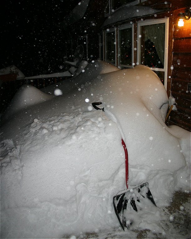
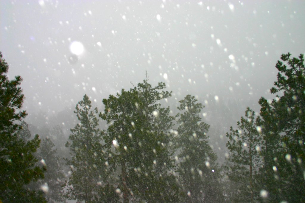
Yesterday's winter storm. now
dubbed the "Holiday Blizzard", dumped
nearly two feet of snow across the region with
drifts up to six feet being reported in the Storm
Mountain area. While blowing and drifting has made
accurate measurements difficult, we estimate that
the Storm Mountain area has received an average of
between 20 and 24 inches so far.
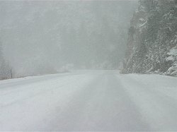
Travel on area roads is reported
as extremely difficult to impossible. Area
residents are advised to stay home today. If you
must travel, carry a "Winter
Survival Kit" with you. If you get
stranded, stay with your vehicle and wait for help
to arrive.
The
complete text of the official warnings for our
area, in effect until noon today, can be found via the links provided below.
A large and potent winter storm is
now moving into the area with snow totals now
predicted in the 1 to 3 feet in our immediate
area. A Winter Storm Warning remains in effect
until 12PM MST on Thursday.
A Blizzard Warning is in effect
for the majority of eastern Colorado from the I-25
urban corridor to the Kansas border. The majority
of schools along and east of the I-25 urban
corridor are "closed". Thompson Valley
and Estes Park schools are being reported as open.
Area residents are advised to be
prepared for difficult to impossible driving
conditions, particularly on rural roads, beginning
this morning and continuing through Friday
morning. It is also advised that travelers check
local media outlets before departing for
information on road closures, flight delays,
etc...
This is a major winter storm
and proper precautions should be taken! If you
must travel, carry a "Winter
Survival Kit" with you. If you get
stranded, stay with your vehicle and wait for help
to arrive.
The
complete text of the official warnings for our
area can be found via the links provided below.
The National Weather Service in Denver has
issued a Winter Storm Warning for the majority of
Colorado, including the Drake, Glen Haven and
Storm Mountain areas, in effect from 6AM MST
Wednesday through 5PM MST on Thursday.
SNOW WILL DEVELOP THIS
EVENING WITH WIDESPREAD SNOWFALL COMMENCING
OVERNIGHT TONIGHT. THIS WILL CONTINUE INTO
THURSDAY WITH TOTAL SNOWFALL AMOUNTS OF 12 TO 24
INCHES. NORTHEAST WINDS OF 10 TO 20 MPH ARE
EXPECTED BY WEDNESDAY AFTERNOON AND WILL CAUSE
BLOWING AND DRIFTING SNOW.
REMEMBER, A WINTER STORM
WARNING MEANS HAZARDOUS WINTER WEATHER CONDITIONS
ARE IMMINENT OR HIGHLY LIKELY. SIGNIFICANT SNOW
ACCUMULATIONS ARE OCCURRING OR EXPECTED. STRONG
WINDS ARE ALSO POSSIBLE. THIS WILL MAKE TRAVEL
VERY HAZARDOUS OR IMPOSSIBLE.
The complete text of this official weather
warning can be found via the link provided below.
The National Weather Service in Denver has
issued a Winter Storm Watch for the majority of
our area, including the Drake, Glen Haven and
Storm Mountain areas, in effect from early
Wednesday morning through late Wednesday night.
A significant Winter storm is now taking aim on
northeast and north-central Colorado. An area of
snowfall will begin in advance of the storm today.
As the storm approaches snow will increase with a
high possibility of heavy snowfall in northeastern
Colorado and along the I-25 urban corridor.
Current models are predicting accumulations of 5
to 10 inches in the watch area.
In addition, strong northerly winds will
increase with gusts up to 40mph possible. This may
produce blowing and drifting snow making travel
extremely difficult to impossible in some
areas.
Residents are advised to stay tuned to local
media outlets for the latest information including
any warnings or advisories associated with this
very potent winter storm. Be prepared for winter
driving conditions beginning late today and
continuing through Thursday morning.
The complete text of this official watch can be
found via the link provided below.
Monday, December 18th
- Slippery Start To The Day...
Commuters across the area are starting their
day today with a slippery ride to work or school
as yesterday's snowstorm has left the majority of
area roads snow-packed and icy.
Residents are advised to use caution this
morning if traveling and to allow extra time to
get to their destinations. Highway 34 is reported
as snow-packed with icy spots. Chains, adequate
snow-tires and 4WD are highly recommended on rural
roads. CR 41H, Storm Mountain Drive. is reported
as very slippery in spots with icing in the usual
areas.
Winter driving conditions are expected to
continue throughout the week with another system
expected to bring more snow and cold to our area
mid-week. No weather watches, warnings or
advisories are currently in effect for our
immediate area.
Listen to this article
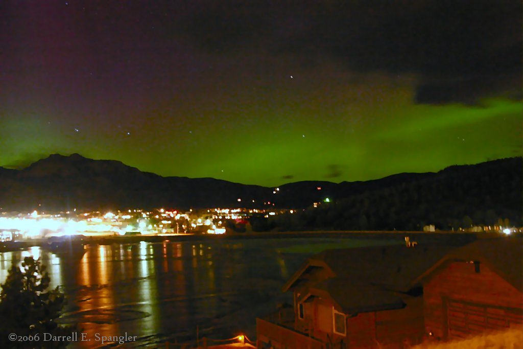
Northern Lights over
Lake Estes on
Thursday evening.
This week's photo features a view of the
beautiful display of the Aurora Borealis, commonly
called the Northern Lights, as seen over Lake
Estes on the evening of Thursday, December 14th.
This display of the Aurora Borealis started
around
sunset and continued for about an hour. An intense
green glow was seen on the northern horizon with
curtains of red and purple rising high into the
sky.
Auroras are somewhat uncommon in our area due
to our more southern latitude. However, strong
geomagnetic storms like the one on Thursday
evening, can sometimes send auroras as far south as Arizona.
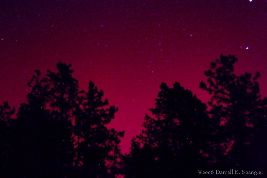
Listen to this article
Northern Lights over Storm Mountain on
Thursday evening.
A second large eruption of sunspot 930 has
possibly sent another CME (Coronal Mass Ejection)
towards Earth. If so, it should arrive on December
16th, re-energizing geomagnetic and auroral
activity.
On Thursday evening a superb display was
reported across the United States and Canada, with
Northern Lights reaching well into our local area.
Between 6PM and 7PM last night beautiful greens
and deep magenta reds could be seen from Estes
Park to Loveland.
Sky-watchers are advised to stay alert tonight
for more auroras beginning at sunset. The best
photos can be obtained by using a 30 second
exposure and a fast speed film or ISO setting. The
Geminids are still active also, with several large
meteors reported during the Northern Lights
display on Thursday evening.
Complete information on upcoming auroral
displays, as well as many photos of last nights
Northern Lights, can be found by visiting www.spaceweather.com
.