__________________
Homeland Security
____________________
____________________


__________________
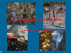
"The Storm Mountain Incident"
Pollution of our
National Forest Streams
(Requires
Free PowerPoint Viewer available here)
__________________

Contamination to Storm Mountain Properties
Click here for the facts!
__________________
__________________
![]()

![]()


__________________
![]()
__________________
|
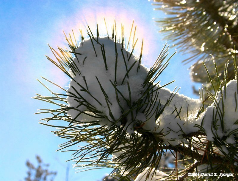
Sunday, November 21st - Beautiful Mountain Morning... Yesterday's snows left the hillside frosted in a blanket of white making for a beautiful mountain morning today... Rays of sunlight twinkled off snow crystals creating miniature rainbows in the rising mist... The photo below shows both the rainbow effect and what is known as "Crepuscular Rays", emanating from a snow covered pine branch... This colorful display is caused as sunlight is refracted through the tiny water droplets in the rapidly evaporating mist from the sunlight on the snow...
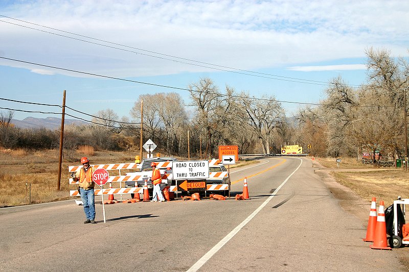
Saturday, November 20th - Winter Storm Warning Downgraded To Advisory... The National Weather Service in Denver has cancelled the previous "Winter Storm Warning" and issued a "Winter Weather Advisory" for the front range foothills until 12am MST... The storm over the southwestern United States has taken a path that will have less impact over northeast and north-central Colorado tonight... Snow is still possible but amounts will be considerably less than earlier thought... It now appears the highest snow amounts will occur along the foothills from Douglas County north to the Wyoming border with an additional 4 inches of accumulation possible... Residents of the Storm Mountain area are advised to use 4WD and or chains on FDR 128... As of 5:30pm, conditions are snow-packed with some icing at the usual spots...These conditions are expected to deteriorate on FDR 128 and other area roads as temperatures fall tonight... Extreme caution is recommended for late night and/or early morning travel throughout the area... WINTER STORM WARNING ISSUED THRU SUNDAY... The National Weather Service in Denver has issued a "Winter Storm Warning" for most of the front range mountains and foothill, including the Storm Mountain area, effective until 6am MST on Sunday... THIS IS A WARNING! An area of snowfall will stall today over Northern Colorado and intensify... Upslope winds will enhance the snowfall along the east slopes of the Continental Divide and along the base of the foothills from the western suburbs of Denver north to Fort Collins... The most likely period for heavy snow will be in the late afternoon and evening... Snow totals are expected to range from 8 to 16 inches in the mountains and foothills, with 6 to 12 inches expected along the I-25 corridor... Friday, November 19th - Winter Storm Watch Thru Saturday Night... The National Weather Service in Denver has issued a "Winter Storm Watch" for the foothills and urban corridor, including the Storm Mountain area, effective tonight at midnight and continuing through Saturday night... THIS IS A WATCH AND NOT A WARNING! Heavy snow is expected in and near the front range foothills... A strong Pacific storm system is expected to drop out of the Pacific Northwest and into Utah on Saturday with conditions favorable for heavy snowfall throughout the watch area... Potential snow amounts will range from 6 to 12 inches in the foothills and mountains, mainly east of the Continental Divide... Hwy 34 To Remain Closed Through Tuesday... The road and bridge work on Hwy 34 has been extended through Tuesday, November 23rd... The majority of the work is now completed with final surfacing in process... Weather permitting, crews should complete the work this weekend with the road re-opening to traffic late Tuesday evening...
Thursday, November 18th - EPA To Investigate Contamination From Access Road... It has been reported that the Federal Environmental Protection Agency is launching an investigation into the possible contamination to protected waters stemming from chemical reactions leeching hazardous chemicals from FDR 128... The goal of this investigation is reportedly to identify the point source of the contamination and mandate clean-up operations, if indicated... This investigation is reportedly in response to oxygen depletion currently being reported in the Big Thompson River below it's merge with the North Fork, and both rivers' status as 303D protected watersheds... It is also being reported that the stream along FDR 128 is protected with Federal 303D status as well... More information will be posted as it becomes available... Leonid Meteor Shower To Peak Tomorrow... The annual Leonid Meteor Shower is predicted to peak tomorrow, November 19th at 2:49pm MST... While this peak is in the daylight hours, sky watchers may still see Leonids both tonight and tomorrow night, weather permitting... Current predictions are for partly cloudy skies through the period allowing viewing opportunities... The best time to look is between midnight and dawn when we are on the side of Earth plowing through the cosmic dust... This is similar to driving into snowflakes with your headlights on... Complete information the 2004 Leonid Shower can be found at Spaceweather.com
Storm Mountain Net |

Disclaimer: Stories and other content are submitted by independent sources and do not represent the opinions or views of Storm Mountain Net, nor it's employees... All stories are posted without bias to their content... While every attempt is made to be concise in our reporting, Storm Mountain Net is not responsible for any incorrect information...